 DARCH
DARCHThe parcel, found.
Boundary, lot area, and available zoning pulled from public records, with the sources attached.
NEWDARCH FOR ARCHITECTS
Bring parcel context, zoning research, and editable 3D massing into early design. Test a program, review assumptions, and develop a schematic starting point.
Address search © OpenStreetMap contributors
Guided tour of a real DARCH study at 601 Brickell Key Drive, Miami. Runs entirely in your browser; conceptual, not an entitlement. Satellite imagery: Esri World Imagery.Real DARCH study · 601 Brickell Key Dr, Miami · Conceptual · Imagery: Esri
ONE ADDRESS IN
Everything you need for the first serious conversation about a site, in one workspace instead of four vendors.
Boundary, lot area, and available zoning pulled from public records, with the sources attached.
A tower, podium, or mid-rise shaped by your program and the site’s setbacks and height plane.
Gross floor area, unit mix, and parking estimates that update as you reshape the model.
Captured views, AI renderings, and a PDF you can put in front of partners the same day.
HOW IT WORKS / THREE STEPS
No CAD file, no consultant kickoff, no download. Start with the address you already have.
Try Massing Builder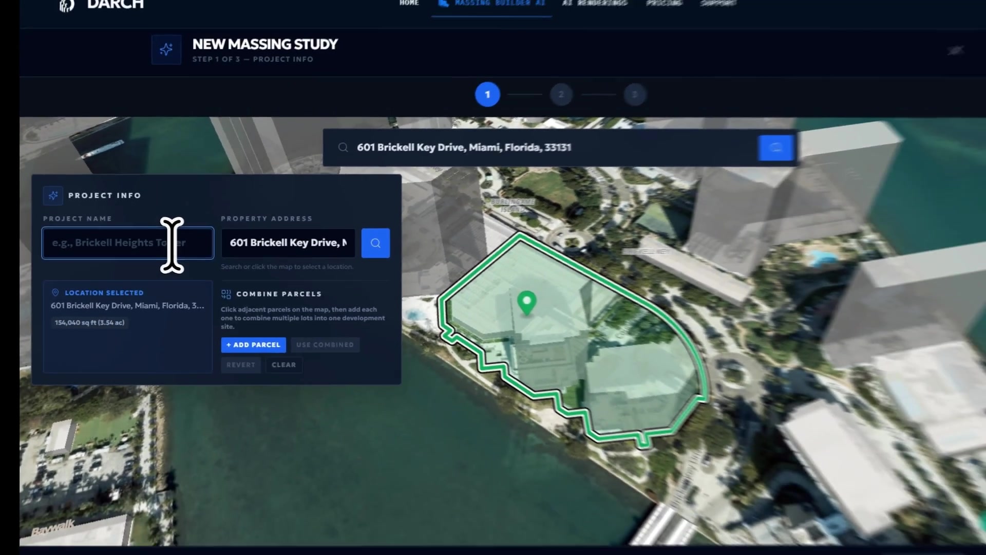 SITE & ZONING
DARCH locates the parcel, confirms the boundary, and gathers the zoning context that shapes what can be built.
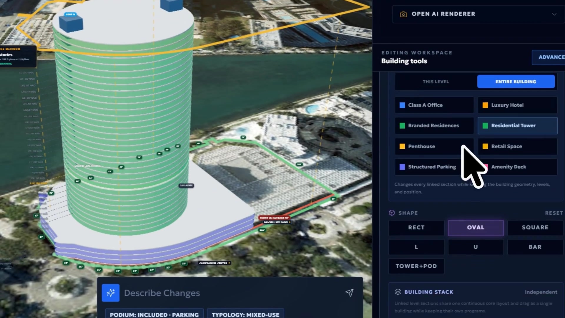 EDITABLE 3D MASSING
“Residential tower over a parking podium.” Get a zoning-informed massing, then change shapes, heights, and uses in plain language or by hand.
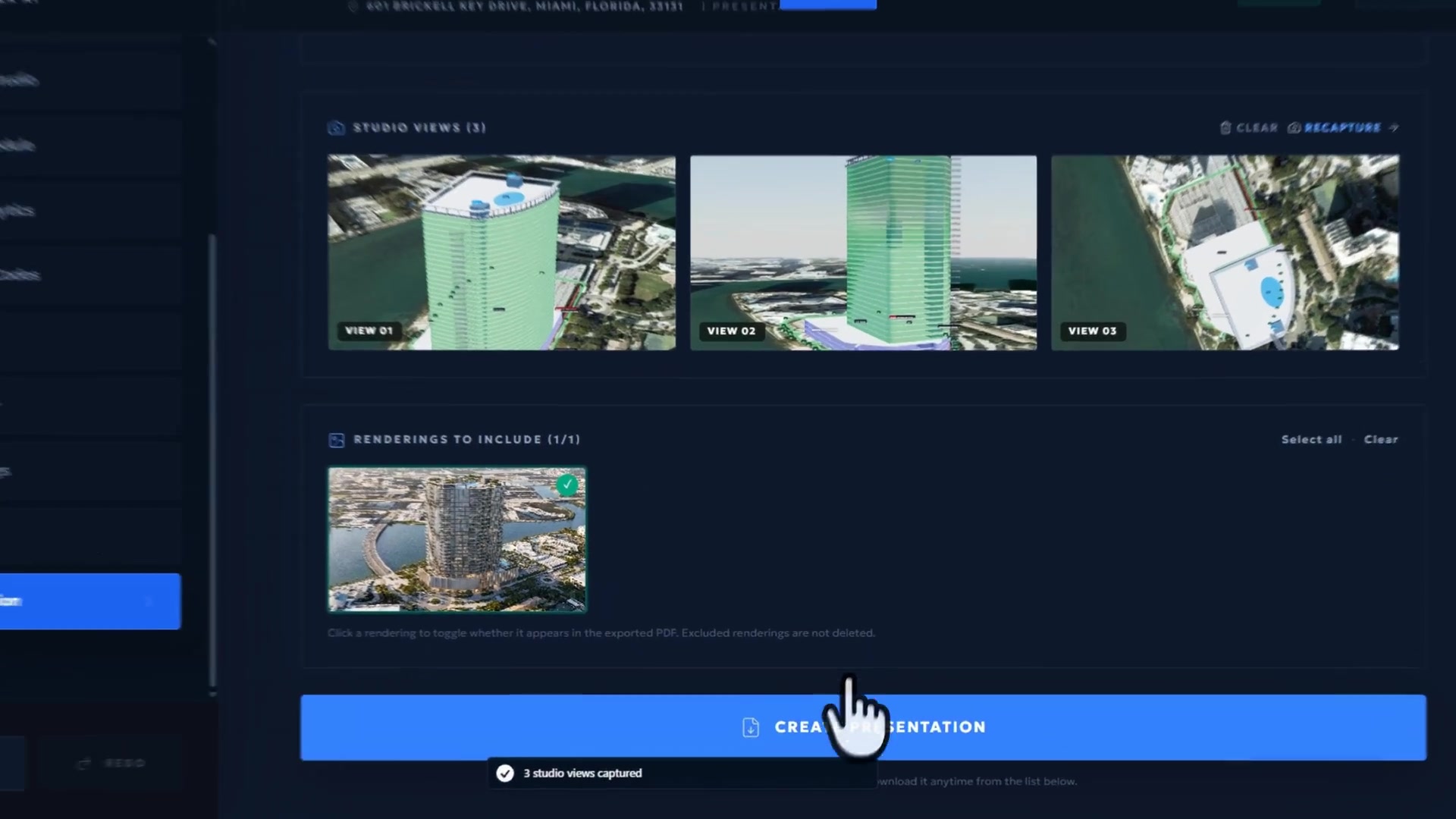 SHAREABLE PRESENTATION
Capture views, render the concept, and export a presentation with the model, the metrics, and the sources behind them.
WHY TEAMS SWITCH
SEE THE REAL PRODUCT
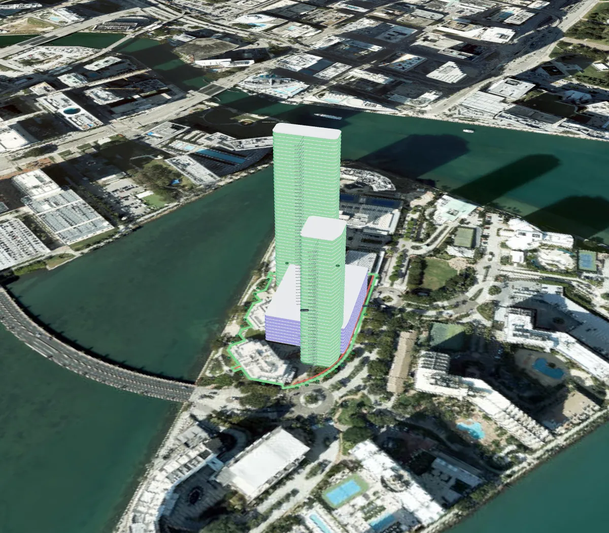
A tower and podium in real site context, with program, zoning references, and metrics in the same view.
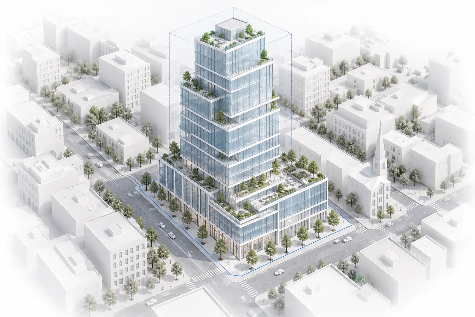 01 · YOUR MASSING
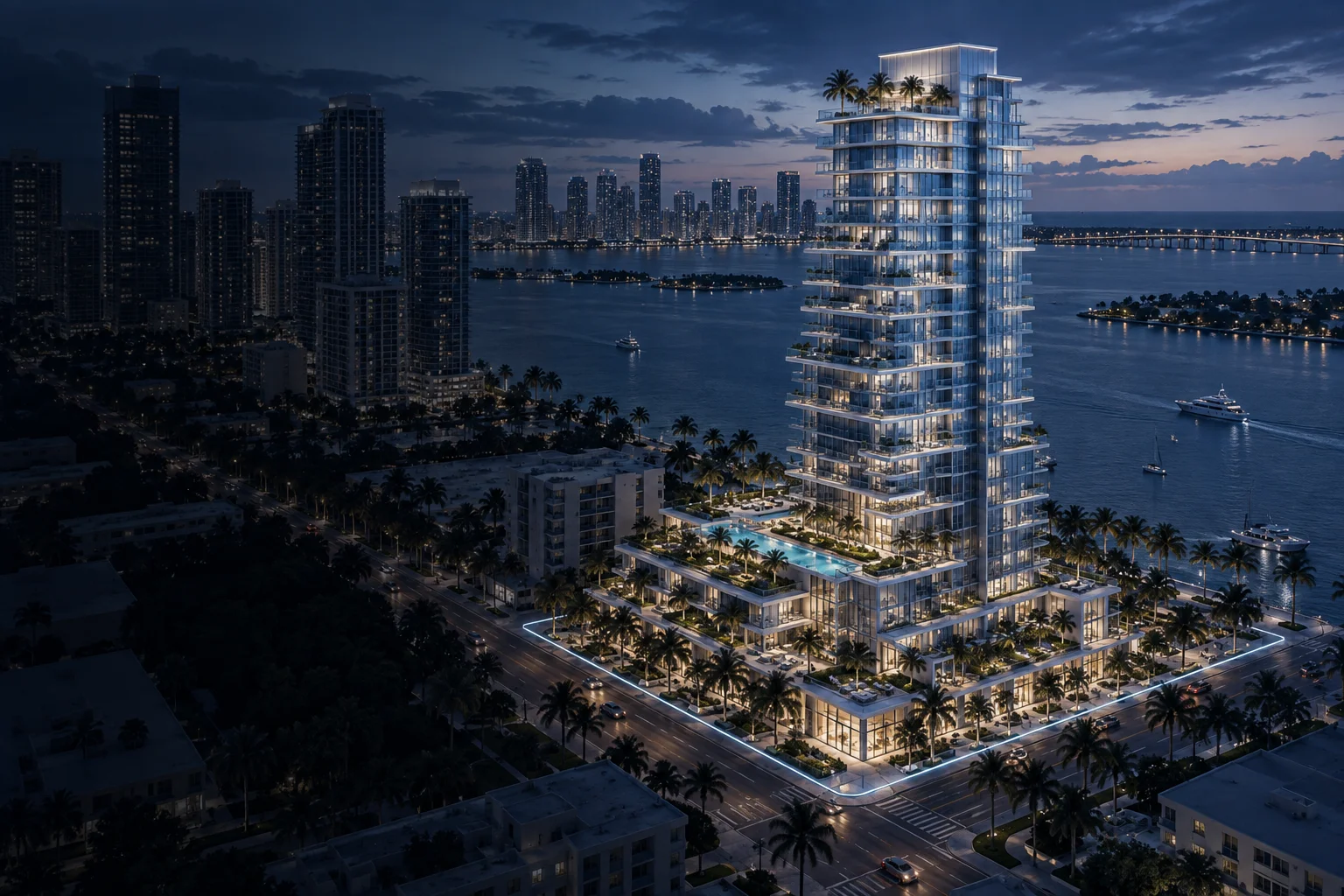 02 · YOUR VISION
Conceptual AI visualizations
FROM MASSING TO VISION
Turn a white-clay study into the image that sells the idea. Presentation-ready views for clients, partners, and your team.
4K render batches are part of your plan. Choose the subscription that fits your workflow.
SIMPLE PLANS
Every plan includes zoning research, 4K render batches, and commercial-use exports. Monthly or annual billing.
2 AI massing studies
5 AI massings / month
Explore a few sites before taking the next step.
See Lite30 AI massings / month
Keep an active pipeline of sites and client presentations moving.
See Studio50 AI massings / month
Evaluate more deals, listings, and multi-parcel opportunities.
See FirmBUILT AROUND YOUR NEXT DECISION
Test a program and review approximate capacity before investing more in due diligence.
FOR BROKERSGive buyers a visual starting point for a more productive development conversation.
FOR ARCHITECTSStart with a working massing and source references, then refine the architectural direction.
KNOW WHAT’S BEHIND THE NUMBERS
Good feasibility starts with the right questions. DARCH brings available records and AI-assisted research together, with sources you can review and assumptions you can challenge.
Explore DARCH for architectsGuest parcel lookup, boundary, and available zoning designation. City of Miami primary zoning is checked separately.
Miami feasibility guide Miami 21 · T6-24 guideTitle 30 research starting point. Guest parcel and zoning preview is not yet available.
Clark County feasibility guideAddress search is available. Workspace parcel providers and zoning research vary by jurisdiction and source availability.
DARCH retrieves zoning information to create zoning-informed massings. Review source dates, overlays, and site-specific requirements.
An editable conceptual 3D massing with site context, zoning research, and development metrics such as gross floor area, unit mix, and estimated parking. You can refine the program and prepare presentation views and PDF reports.
Yes. Search an address and preview available public parcel and zoning data. Guest GIS previews currently cover Miami-Dade, with City of Miami zoning queried separately. Elsewhere, you can locate an address, but parcel and zoning details may require research inside the workspace.
New accounts receive 2 free AI massing studies, with no credit card required to sign up. The allowance is a lifetime trial, not a monthly renewal. See the pricing page for ongoing plans and export entitlements. View plans
Yes. Free renderings are included with DARCH subscriptions, with 4K render batches available as part of your plan. Rendering allowances and features vary by subscription. Visit Pricing to compare plans.
DARCH retrieves zoning information and combines it with available parcel records and AI-assisted research to create zoning-informed massings. Review the source references, assumptions, missing fields, and conflicts for your site.
No. Lot area multiplied by floor area ratio is a preliminary floor-area calculation. Height, setbacks, lot coverage, density, parking, access, and other site-specific requirements can constrain the actual building. DARCH lets you explore those relationships in a massing study.
No. DARCH runs in your browser. Create an account when you are ready to develop and save a study; editing and exports take place in the workspace.
YOUR NEXT OPPORTUNITY STARTS HERE
2 free studies to get started. Free renderings with subscriptions.